Why old maps of Northeastern Africa are not old:
Cartographic collections as a repository of local territorial knowledge and practice
Wolbert G.C. Smidt
Online-Vortrag am 13. April 2022, 18:00 Uhr, Zoom
Old maps of Northeastern Africa have still to be re-discovered from an anthropological perspective. Especially maps dating from the 19th century contain a wealth of information on toponyms, regional names and the territorial extension of groups, local concepts of boundaries and of routes, overlaps of political claims, ethnic tensions and interactions, and even ecology and archaeology. However, they have almost not yet been subject of systematic studies. They are loved by collectioners, in some cases used as a rather anecdotal reference in academic works, while anthropology, especially ethnohistory, could still make much out of them, especially in combination with other sources on territorial traditions and local socio-political practices.
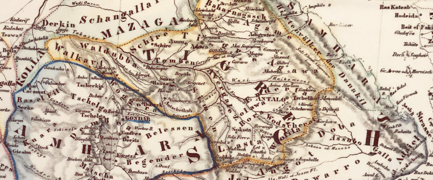
This paper presents several examples from old maps from the 17th to 19th centuries, which show that they were not simply „external“ products of travelling cartographers and researchers, but rather results of an intense local support and communication with experienced local partners, who were specialists for territorial knowledge and socio-political practices. Despite simplifications and incompleteness, the „indigenous“ information stored on the maps is extremely rich and helps to understand political and cultural-territorial processes. In numerous cases the territorial realities we find on old maps are part of ongoing and unfinished processes until today and have effects on local identities and territorial self-definition. That is why the re-reading of old maps can be fruitful as an additional instrument to interpret modern political and political-cultural processes in a both highly dynamic, and highly conservative Northeastern Africa, whose regions, populations and cultures are marked by strong local identities.
Die Vorträge werden über Zoom-Meetings abgehalten. Bitte melden Sie sich per Email als Zuhörer*in an.